About admin

This author has not yet filled in any details.
So far admin has created 57 blog entries.

Leg 1-2001: Gothenburg, Sweden; Tromso, Norway

Leg 1-2001: Gothenburg, Sweden; Tromso, Norway

May 15, 2001 1145 57.42N, 11.57E Log:41,767 Baro: 1005

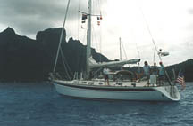
Moored in front of Gothenburg Opera House In just 15 minutes our first sailing leg of our 12th season starts! For the past 2.5 weeks we have been getting Mahina Tiare ready for her longest season ever, from May 15, 2001 here in Gothenburg, ending February 15th, 2002 in lovely Hilo, Hawaii.
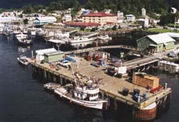
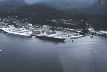

Gothenburg Harbor

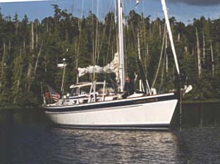
Varnish is done, the sun is out and Mahina Tiare is ready for more sailing fun!

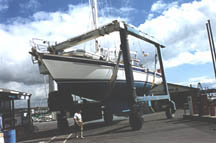
We had excellent help from the busy crew at Hallberg-Rassy, and arrived back in Ellos to find MT already painted, waxed, rigged and launched. Vickie Vance (Leg 1-1991) owner of HR Parts and Accessories helped us track down the last little spare and replacement parts, and for that we owe her a big thanks!

Our final day at the Hallberg Rassy boatyard in Ellos, Sweden.
Mahina Tiare is sparkling and ready for adventure.

We also want to thank Roland Olsson and Magnus Rassy for organizing our haulout and winter storage and Bo and his ever-friendly and helpful crew for helping us sort out our recommissioning.

H-R Parts and Accessories crew: Anette, Vickie Vance and Eva helped us find parts for Mahina Tiare in Ellos.

Some of Hallberg Rassy’s crew enjoying a sunny lunch break after a long, cold winter.

The 45 mile sail south from Ellos to Gothenburg was in HOT sunny weather (hard to believe it snowed the week before we arrived!) past dozens of postcard-perfect little Swedish villages on coastal islands.


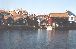
One of many picturesque Swedish villages we passed en route from Ellos to Gothenburg.

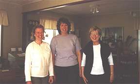
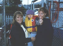
Lars and Susanne and their kids Elanor and Daniel (Leg 10-98) met us with their fishing charter boat at Marstrand and let us tie to their dock for the past few days in Hjuvik, downriver from Gothenburg.

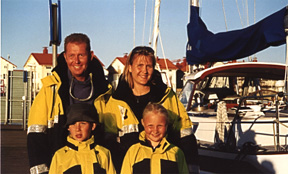
Lars, Susanne, Daniel and Elanor Johansson Leg 9-98 expedition members Hosting us at Gothenburg.


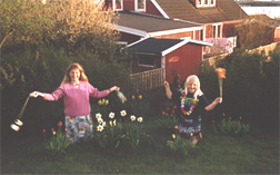
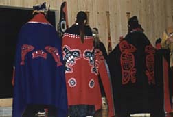
Amanda teaching Elanor a Maori Poi dance in Hjuvik.

It’s been a little cool and hazy, but this morning the sun is beaming through and it looks like we have a great forecast to blast directly offshore to Norway.

I’d better go up and greet the crew as it’s nearly noon and they are pacing the dock, eager to join us! We look forward to sharing this year of adventure with you.

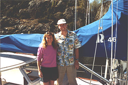
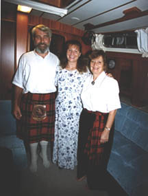
Tania and Marcel Legs 8-98 and 4-99 enjoying their first night aboard Alegria, their new HR 42.

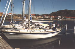
After many years of hard work in Oman, Tania and Marcel christened Alegria
and plan to cross the Atlantic the same time we do.

Leg 1 May 21,2001 0200 62.21N, 05.22E Log: 42317 Baro:1019
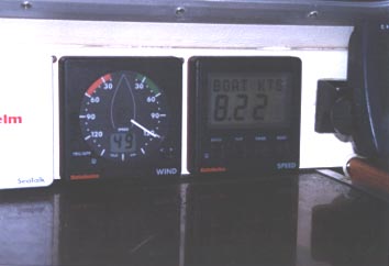
Winds: SW 30-39kts Depth: 150′ Seas: Impressive!

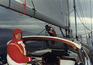
Tearing Through Twilight!

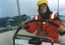
We are ripping along on a broad reach, two reefs in the main, three in the jib. Floro Radio keeps announcing gale warnings, as if we needed a reminder!

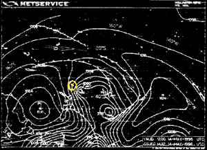
This morning we left the tiny bulletproof anchorage of Vikingsvagen with a cloudless sky and glass seas. Cliff worked from 2200 until 0400 charting a tortuous route with over 40 waypoints, sliding past some of Norway’s spectacular fjords. However, when we crossed Sognfjord entrance we looked out to sea and saw wind. This sparked an idea to sail 140 miles along the coast to Alesund instead of motoring many twisting and turning miles inside the channels. Our goal is to utilize every sailing opportunity and the weatherfax charts from Germany showing following winds preceding a cold front cemented our decision.

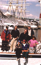
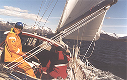
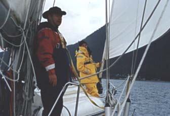
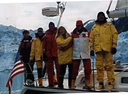
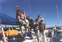
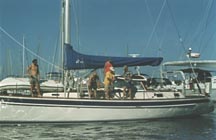
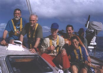
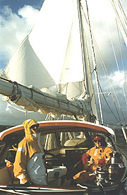
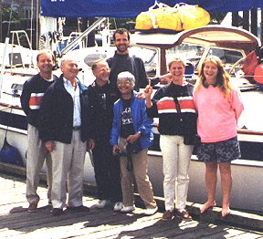
Leg 1 – 2001 crew ready to sail north from Gothenburg.

In the early afternoon we joked about in ideal sailing conditions, broad reaching in 15kts, but the wind kept increasing until grins and rain blew about in the 30’s and twightlight was a steel grey at 0100.

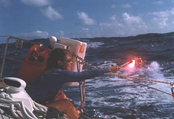
The expedition has been flying by – we’ve already sailed 540 miles since leaving Gothenburg. We always ask our expedition members what skills they most want to work on, and 4 out of 6 Leg 1 crew mentioned heavy weather. They didn’t have to wait long! We set sail Wed. morn from Hjuvik on a broad reach. By early afternoon we passed the northern tip of Denmark and the wind, seas and traffic kept building until by 2300 we had 32kts, steep short seas that the Kattegut is famous for, and 8 ships within the 3 mile range on radar.

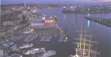
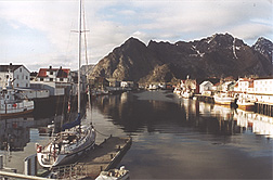
With following winds we rounded the southern cape of Norway and sailed north, passing Stavanger, before stopping on Friday at Bergen, Norway’s second largest city. We rafted to Bor, an 80′ traditional gaff schooner for two nights while crew explored town. The harbormaster came by to collect fees (only $8US equivalent for two nights) and spent an hour marking our charts. As we were missing a few charts, he dropped us at the chart agent in town who had every charts we needed in stock, at only $15US each!

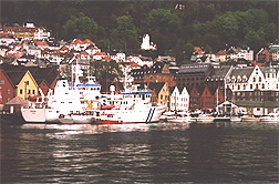
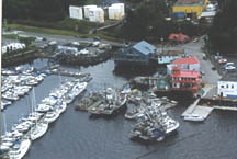
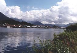
Bergen, Norway harbor

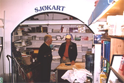
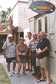
Buying the lasy of our charts in Bergen, Norway.

Hey, I’ve gotta run, we’re now in a channel heading for Alesund and Elizabeth and Amanda are trying to identify lights of the bridge we have to sail under.

May 25, 2001 2020 63.30N, 09.07E Log: 42,470 Baro: 1020

We made Alesund by 0700 and enjoyed a quiet night tied up in the center of this attractive art-nouveau influenced city. We met a lively British couple on a Nauticat 35, also sailing to Spitsbergen and had a Dutch couple on an older Huisman sloop rafted up to us. It was exciting to be exchanging chart and weather info with boats headed the same way!


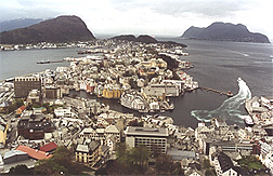
The delightful town of Alesund from Aksla Hill.


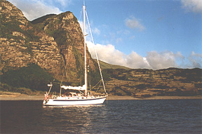
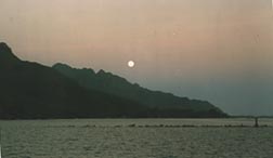
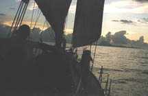
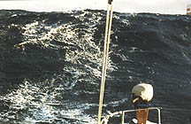
Sliding past Norway’s spectacular fjords.

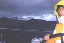
The following morning we had a blistering downwind sail, gybing our way down twisting fjords with winds touching 40kts, and just a bit of sleet! The weatherfax charts from Germany showed another cold front about to roar through, so we sailed hard, reaching the tiny fishing village of Bud at 1530. Like so many Norwegian villages, Bud has a visitors float with an honesty box, $7US equivalent for moorage, including water & garbage. Ashore we explored the remains of the German WWII fort and went for long walks and runs yesterday as we were stormbound with 45+ knot winds and breaking seas offshore.

This morning the winds and seas had diminished, so we sailed north, with a brief look around Kristiansted. We will have covered nearly 90 miles by the time we stop in Kongsvoll. Our goal is to get up to the Lofoten Islands relatively quickly so that we can have several days to explore this isolated and dramatic offshore group.

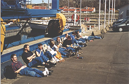
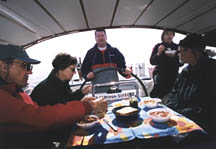
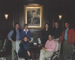
Here’s our Leg 1 crew:
Elizabeth Peter, 51 is a doc who lives near Vancouver, BC where she and her husband David are preparing their Fast Passage 39 for a voyage to the South Pacific this fall.

Sheryl Howard, 46 is an engineer at Lockheed in San Jose, a pilot and sailed a new HR 39 from Sweden to Florida last summer. She sails her Cape Dory 30 on San Francisco Bay.

Tim Whitlock, 52 works for Timberjack, a division of John Deere in Ontario and sails his CS 22 on Lake Huron.

John Fink, 46 is a neurologist from Ann Arbor, Michigan and enjoys sharing sailing 470’s with his 6, 10 and 12 year olds and his wife Cindy.

Henry Sharpe, 57 recently retired from being a strategic advisor for the mayor and city council of Seattle. He enjoys singlehanding his Alberg 30 out of Bainbridge Island and recently returned from a four month advisory position with the Vietnamese government.

Cliff Wood, 46 a software engineer from Caldwell, Idaho enjoys flying his Maule aircraft into backcountry mountain airstrips.

Leg 1 2001 May 3
Tromso 69.38N 18.47 E Baro 1003

We have arrived in the trendy university town of Tromso and Leg 1 is drawing to a close with crew members packing bags for further destinations and adventures to Spitsbergen, Finmark and warmer European cities before heading home. This 3 week 1,300 mile expedition has been a delight and the following is a summary of the highlights we experienced since leaving Bud and general cruising information.

Louvund Island  May 28, 66.22N 12.22E The last 3 days we have sailed 240 miles, coastal and offshore ,to just below the Arctic Circle. Lovund’s steep mountain is home to 200,000 puffins who return in the summer months to nest. We enjoyed a pleasant midnight sun evening high on the hill viewing hundreds of comic little puffins coming home for the night.

Puffin watching in the midnight sun on Louvund Island.


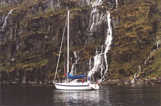
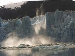
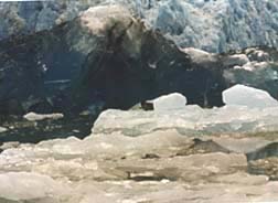
Svartisen Glacier  May 29, 66.42N  13.37E
 Svartisen is Norways second largest icecap and it seemed only fitting that we should celebrate our Arctic Circle crossing with a glacial evening hike up the ice tongue that licked the grassy lowland. The following morning saw arctic initiation swims in the shadow of the glacier from hardy crew and a showy photo opportunity.


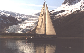
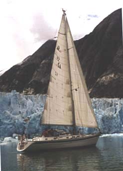
Ghosting past Svartisen Glacier.

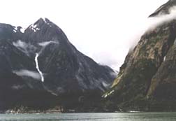
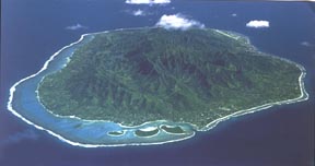
Lofoten Islands  June 1, 68.13N 14.34E After a short supply stop in the working harbor town of Bodo we jumped off across the Vestfjorden for the Loften Wall, a 70 mile expanse of jagged glacier carved peaks stretching along the Lofoten archipelago. We spent a windless crossing practicing celestial navigation and rope work while watching the snowy wall loom closer and arrived to the sight of small fishing villages and grassy farms fringing the towering peaks like the brim of a sombrero.


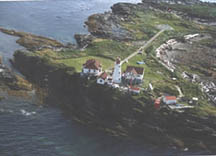
The fishing town of Henningsvaer nestled under the Lofoten wall
.
The trendy fishing town Hennsingsvaer was our first stop and interesting galleries and scenic walks alongside the harbor and open-air cod drying racks gave us a window into the islands charms. Time stands still and locals go about their traditional fishing, farming and home activities around the clock. Sailing a few miles further north to the main town of Svolvaer, the tempo changed to a town alive and bustling with its annual international blues festival, though entertainment was $25 a venue na dstarted at 11pm.


Troll searching in Trollfjorden, Lofotens.

As a farewell we cruised the Trollfjorden, dramatically narrow and deep with glistening snowy mountains and extensive waterfalls, before sailing the last 150 miles inside scenic Senja Island to Tromso.


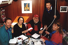
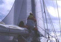
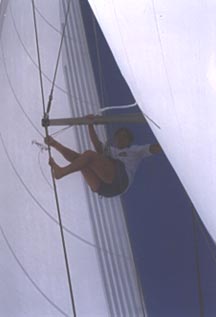
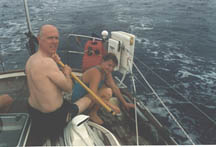
Leg 1 crew learn the ropes.

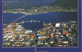
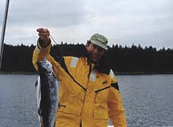
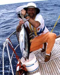
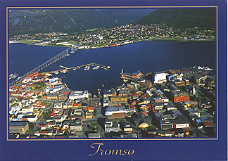
Tromso  June 11 We’ve enjoyed exploring this attractive Arctic city with it’s accommodating guest harbor in the middle of town. If I were asked to give it a sister city I would say Hobart, Tasmania with a lot more snow. Cafe’s galleries, outdoor markets, museums, pubs and parks spread along the waterfront and the tourist office is more then helpful for extra imquires for places to visit and boat projects to complete. As  a university town and leaping off spot for Spitsbergen, a 1 1/2 hour flight away, Tromso has an energy akin to Ushuaia in South America and people are out and about viewing the sights at all  hours. John and I have prepped Mahina Tiare and we are now enjoying a free week of museums, Spitsbergen education, fellow cruisiers, staying fit in the local pool ( though they only do breaststroke) and catching cod…I’m getting pretty good at it.   Weather Perfect…chilly but perfect. For the month of May the barometer has remained relatively steady in the mid 1004 range and weather systems have passed at a predictable pace. The best weatherfax information comes from Germany twice a day and is easily interpreted. We experienced no fog and have had light winds from the south since leaving Bud.

Charts and Cruising Guides  The Norwegian Cruising Guide by John Armitage provides invaluable advice information for over 500 anchorages and harbors. The Norwegian Pilot, Den Norske Los are available in 7 volumes, though 4-6 do not have English text, only Norwegian. These excellent publications with color areal photo’s and harbor plans but cost $40 each. Norwegian Charts cost $15 each, are of  superb quality and available in most city bookstores. The 100 series provides terrific coverage at 1:50 000 and we have a total of 70 charts for coastal Norway with a few large scale charts for overall trip planning. Electronic Charting proved to be extremely limited and expensive and with coverage only in the south to Alesund.


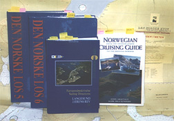
Norwegian Sailing Directions and Cruising Guides.

Navigation You need take a few minutes to familiarize yourself with the Norwegian buoyage system Towers or cairns, made of stones and rock piles, some containing pointing arms, are the oldest system of navigation aids while beacons, perches, sector lights, cardinal marks and buoys total 13,000 adding to at first an impossible confusing route in narrow channels. Bridges and power cables are numerous and heights are only noted on the charts.

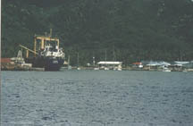
Moorage We’ve been amazed at how populated Norway is and in our voyage north we have not spent one night where there has been fewer than 5 cabins ashore. Small harbors with guest pontoons are frequent in even the smallest town while cities have additional facilities. Dockside fees have averaged $8 per night while showers ($2 ) and laundry ($6 wash and dry) are available with a  key deposit. Be warned that washing machines and dryers tend to take 2 hours per session.

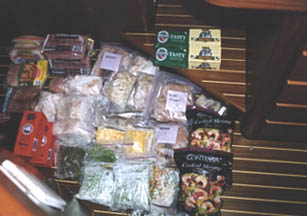
Provisioning and Fuel Grocery stores contain great supplies at about 25% more than the U.S and fuel at approximately $2.50 U.S is available in large towns. Foreign credit cards are often not accepted at many supermarkets and fueling stations but ATM machines abound.


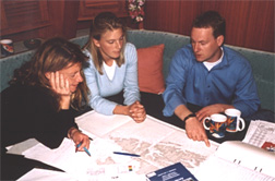
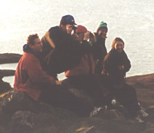
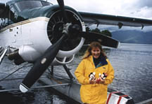
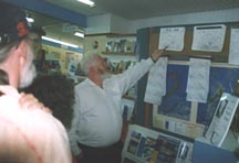
Katarina and Per Magnus of Polar Quest going over charts of Spitsbergen with us.

Leg 1-2001: Gothenburg, Sweden; Tromso, Norway2021-04-27T11:54:57+00:00

Leg 5-2000 : Tortola, BVI to Azores

July 1, 2000 2130
26.06N, 62.14W Log: 37,195

Sailing Through Paradise!

We’re well on our way to the Azores, 900 miles west of Portugal, having set sail from Jost Van Dyke in the British Virgin Islands three days ago. The winds have been awesome, allowing us to cover up to 170 miles per day with smooth seas.

An hour ago at sunset, everyone was in the cockpit, savoring gliding along effortlessly at 7.5 knots on a beam reach with the stars starting to twinkle overhead. A small rain squall on the beam was a contrast to an otherwise perfect tradewind sunset.

Since we arrived in the BVI’s last month all of our windward sailing has been forgotten.

Last Sunday, Amanda and I sailed into Road Town by 0900 and spent the day provisioning, stowing food, doing laundry and getting ready for crew. Sunday afternoon we saw a large high-school steel drum band setting up in front of the new government buildings and the kids told us they were playing at an event celebrating the 20th anniversary of social security for the BVI’s.

We walked by later, listening to the magical steel drum music that had even the old people dancing in the streets. What a handsome and proud group of people these BVIslanders are! With no unemployment (a shortage of workers, actually), low crime and a good school system, these folks really have a country to be proud of! We never felt one bit of hostility and found the locals were actually far more polite in the crowded supermarket than the bareboater tourists were.

Soon after our new crew joined us on Monday, we took them to the Caribbean Weather Center, www.caribwx.com, where David Jones explained generally how Caribbean and Atlantic weather patterns worked, then using a semi-classified connection to the US Navy, showed us on his computer what our weather would likely be for the next seven days. It was awesome! We all learned a lot, and all bought a copy of his excellent book,”The Concise Guide to Caribbean Weather”, available from his website or from Armchair Sailor in Seattle. David charges $125 per year for custom weather reports over the SSB radio, one heck of a deal for storm avoidance in our opinion!


Leg 5 crew attending a weather briefing with
David Jones (2nd from right) at Caribwx.

After completing a few hours of orientation, we had a rip-roaring sail across to Little Harbor, then Tuesday, sailed down to Soper’s Hole to top up fuel, buy ice creams and then to Great Harbor so we could introduce the crew to Foxy. (For more details on these locations, see leg 4.)

The next morning we covered a lot of our teaching topics, had one last luxurious swim, and after lunch set sail for the Azores, 2,300 miles away.

By the way, on the suggestion of Kent Williams at Armchair Sailor Bookstore in Seattle, armchair@wolfenet.com, we purchased and used extensively the new German-produced Caribbean Yachting Chart Kits of the Virgin Islands, 13 excellent color charts for $69, an excellent value!

Keith Hamilton discovering the joys of machine sewing.

Once again we have a great crew, and one that enjoy lots of jokes and laughs:

Jim Novel, 53, born in Columbia, grew up in Peru, moved to California for college, now works for Intel in Portland, Oregon. His lovely wife Linda joins him in the Azores for 10 weeks of traveling and bicycling through Europe.

Miguel Praca, 43, born in Lisbon has lived in nearly every Portuguese colony in the world. Came to the US for university, now works in Silicon Valley and sails his Caliber 33 out of San Francisco, dreaming of ocean passages on his own boat.

Keith Hamilton, 49 and Rosemary Hamilton, 49 grew up in Hong Kong, were educated in England and moved to Halifax, Nova Scotia where Keith is an anesthesiologist and he and Rosemary have founded a half-way house for troubled youths. They fly on to England from the Azores for sea trials on their new Oyster 47.

Lambros Tterlikkis, 64 was born and educated in Lebanon of Greek parents, came to the US for university and never left. He is a professor of pharmaceutics at Florida A & M Univ. He and his wife

Donna Tterlikkis, 44 sail a Com-Pac 27 out of Carrabelle, FL. Donna is an Environmental Manager for the state of Florida and is one keen sailor! They plan to upgrade and retire to a life of ocean cruising in the near future.

Amanda instructs Donna on filleting a yellowtail tuna, our 6th fish!

July 6, 2000 1900
34.09N, 51.37W, Log: 37,837
Motorsailing into light easterlies between squalls, 1030 miles to Flores, Azores
Halfway Party!
Our fantastic sailing cooled off yesterday and we have been alternating between sailing in light winds and motoring in no winds, dodging squalls. Today we had our half-way party, treats and surprises for all. Overall we’ve had excellent weather and really enjoyed David Jones’ Caribbean Connection custom weather forecasts over the SSB radio each morning. We are forever comparing his forecasts to the weatherfax charts that keep popping out of our Furuno DFAX machine and to actual conditions and find that Jones is uncannily accurate!

We have changed our landfall from Horta, on the island a Faial, to Flores, a garden island 132 miles closer to us, also a Port of Entry. This crew have been so keen to learn everything possible for use on their own cruises that we will finish all of our instruction except for going aloft to check rigging and rebuilding winches before we arrive.

Murals at Horta-Acores

July 16, 2000 0300
38.44N, 29.08W Log: 38,993 Baro: 1015- Winds: SW 20-25
Close reaching @ 7.6 kts, Double reefed main, triple reefed jib

Racing a Cold Front to Horta

Horta is 20 miles ahead, now visible on radar. The barometer continues to drop, down 8 mb in the last 24hrs. Until we receive the next weatherfax chart, we don’t really know when this cold front that is generating the first rain and squally weather of the year for us is going to pass, resulting in clearer skies and a distinct wind shift. The strong Azores high has been blocking the cold front with its gale force winds for the past 12 days, and now it has broken the high in two, forcing its way toward Europe.

When we made landfall on Thursday (only 15 days for the 2,300 mi passage from the BVI’s!) we figured the NE winds would make the normal anchorage behind the breakwater at Lajes uncomfortable, so we anchored in the lee of Flores Island off the small town of Faja Grande.

Flores was breathtakingly dramatic on our approach. Verdant green 2,500′ cliffs with waterfalls, terraced paddocks extending up the hills, and small villages with white-washed buildings and red-tiled roofs made a stunning image.

Mahina Tiare at anchor at Faja Grande, Flores Island.


Picturesque village of Fajazinita, Flores

After anchoring off the small landing in 35′, rocky bottom, Miguel and I dinghied ashore where he called customs from the cafe overlooking the anchorage. I was thankful for Miguel’s Portuguese language skills! Customs told him that there was no problem stopping at Faja Grande which is not a port of entry – they just asked that I go to Santa Cruz, a 20 minute taxi ride, the next day to clear in. No sooner had I landed our crew ashore than a Guardia Nationale jeep pulled up and the officers filled out some forms and confirmed that we needed to check in with the Policia Maritima (coast guard) the following day.

Clearing customs in the back of Guardia Nationale’s jeep, Faja Grande

The cafe was part of a community-run campground, swimming pool, restaurant and free showers operation. We had a fun and excellent dinner there before exploring the historic village in the lingering evening light. Faja Grande was like nothing I’ve ever experienced! Small stone cottages nestle together lining narrow cobble stone lanes. Many houses proudly display dates of 1850 to 1880 and small gardens burst with flowers. Windows were open wide, people smiled and nodded as we glimpsed then, through billowing lace curtains, relaxing at home – it was like going back in time. We learned that the island’s population has dropped from 12,000 to 4,000 since the mid-1850’s when the skilled boatsmen were hired on whaling ships based in New Bedford, Massachusetts. When asked if many emigrated to Portugal, the answer was, “No, we always look to the West, to the US and Canada.” In fact the Azores
people with their reputation as hard workers even migrated to Hawaii, first as whalers, then as immigrants working on the ranches and in the cane fields.

One of the first things we learned was that the Festival of the Emigrants, honoring those who had moved away then returned for the summer holidays would be the next three days in Lajes, starting with the arrival of a ferry with 750 people on Friday. Taking the taxi to Lajes it became clear that the anchorage was very rough, in fact 4 boats who had been anchored there joined us in the protection of Faja Grande.

The taxi ride past spectacular lakes, up into the clouds of the interior mountains and along the striking windward coastline was a rush! Santa Cruz was picturesque with narrow streets, a couple of huge cathedrals and a tiny harbor with ancient beautiful wooden fishing boats pulled up the landing. After clearing in with the coast guard, Amanda and I bought some fresh baguettes, tasty local cheese and ham and sat on the harborfront for a picnic. There were so many interesting sights!

Boat Harbor, Santa Cruz, Flores.

Since our first date in 1994, Amanda has been telling me about the Azores, which she visited while on Maiden, getting ready for the Whitbread Around the World Race. I sure haven’t been disappointed!

By Saturday the wind had started shifting to SW, so we moved around to Lajes and enjoyed the start of the festivities. The main road had been closed to cars, stalls selling food and drinks set up and a huge exhibition tent and restaurant tent erected. Pup tents with the ferry passengers were found in many public parks and marching bands representing several different islands and villages as well as traditional dancing groups performed down the street and on a stage. It seemed that all of Flores 4,000 inhabitants were enjoying the festival to the max! Amanda and I went back to the boat at 2230, and at midnight when the crew returned, they said things were really starting to take off.

Festival of the Emigrant, Lajes, Flores

To give you an idea of how much Lajes values the visitors who arrive by sailboat, they have no charges for using the harbor, there is FREE laundry drop-off service, showers and clean heads at the wharf and free internet at town hall! The town is lobbying hard to have a marina so cruisers will be more comfortable and extend their visits. We were told that Horta has been jealously blocking funding attempts, afraid the yachties will choose to spend their time and money in Flores instead. But with the Horta marina jammed to overflowing (so we’ve read) that isn’t really a big issue.

At noon today we set sail for Horta, on the island of Faial, 123 miles ESE. With strong winds and a good sea running we practiced towing warp and deploying the Galerider drogue, our last two teaching objectives. Upon reaching Horta, we just have winch rebuilding and going up the mast for rigging checks left!

This has been one of our most enjoyable crews of the season, with everyone singing songs and joking around in the cockpit this afternoon as we zoomed along under sail. Everytime I ask for volunteers to tuck a reef in the main, there are twice as many as needed – and that’s a good sign!

July 25, 2000 1500 At Anchor off Horta, Faial Island, Azores
38.32N, 28.37W Log: 39,026 Baro: 1018- Air: 73F
Horta, crossroads of the Atlantic

Arrival in our final port is always a blur! Before long crew had taken off on ferries to explore other islands and Amanda was right into touching up Maiden’s and Taitoa’s (her folks boat) hand painted signs on the breakwater wall. Horta has long been famous for ship’s and yachts painting their names and designs on the wall, and Amanda was delighted to find the 12 year old names still visible.

Farewell crew dinner in Horta.

Mahina Tiare at Horta Marina.

The marina was packed with boats rafted three deep along the breakwater, but we had no problem in getting a secure spot after clearing in. A few days ago we rented a car for the day and explored the island, hiking up a recent volcano, walking along deserted beaches and having lunch at a little seaside cafe. For being the middle of summer, it sure is a quiet island!

This morning on our run we found a group of buildings in Puerto Pim, the next bay around, with a busy crew of 30 guys restoring and painting them. I didn’t plan on going inside since there was a lot of work going on, but as soon as I peered in the huge front doors, an older man asked in broken English if I’d like to see the buildings. I motioned for Amanda to join me and he explained that this whale processing plant had been closed for 25 years but was being restored and would be opening in two months as a museum. He told us how much he enjoyed his life as a whaler, going far offshore in small seven-man open boats, and took us inside to see a fascinating collection of machinery used to extract the oil and turn the meat and bones into chicken feed. An old friend of his who worked in the factory for many years joined us and with our friend interpreting, explained how the machinery worked. These old guys were obviously proud and delighted this bit of history was being preserved.

We are anchored off town where we can see the lights going up for Mar Semana, or Sea Week, the festival which will be starting the day our crew arrive with sailing races, music and excitement. We are enjoying our extra week off and getting in lots of hikes, exploring and swimming before Leg 6 crew join us for the passage to Ireland.

Stay tuned for more exciting adventures!

Leg 5-2000 : Tortola, BVI to Azores2021-04-27T11:33:41+00:00

Leg 5, 1999 Prince Rupert, B.C. to Petersburg, Alaska

September 1, 1999 1100 54.50N 130.57W
Log: 28,783 Baro: 1020 Air: 70F (Can you believe that?)
Winds SSE 3kts, broad reaching @ 2kts in gorgeous sunshine


Prince Rupert Yacht Club (left) and Breakers Pub (center)

We were underway for our first anchorage just three hours after our crew joined us in Prince Rupert, in order to make it through Venn Passage before the 20′ tidal drop made the channel impassable. Last night we ghosted into uninhabited Brundige Inlet on Dundas Island, just a couple of miles from the B.C.-Alaska border. This morning is probably the sunniest and warmest of the year, from what the locals in PR and boats headed south have told us. The first two years I ran expeditions with Mahina Tiare II, 1990 & 91, we sailed Alaska and BC waters in September and early October and heard the same story everywhere we sailed, that summers are generally wet & foggy, but as soon as September rolls around, out comes the sun! We’re hoping that holds true this year too.

We’ve got an interesting crew aboard:

Tarek Abdel-Hamid, 49 is originally from Cairo, Egypt, but is now a computer science prof at Stanford University, and living in the San Francisco area where he sails his gorgeous new Alden 45. He is considering sailing to Alaska in the next year or two and joins us to make sure this is good plan. His long term cruising plans are to sail to the Red Sea and Med with his wife, Nadia, who is also a keen sailor.

Melissa Lockard, 35, joins us from the Seattle area. Melissa and husband Eric’s Hallberg-Rassy 53 is nearing completion now, and they look forward to 8 – 12 week shakedown cruise to Alaska next summer with their 3 and 4 yr old kids. Eric grew up sailing the NW waters with his family each summer and wants to share this with his children.

Keith Murphy, 55 is a sailor and fisherman from Seattle who is also an IBM consultant and just enjoys being on the water. We are really looking forward to his coaching in how to catch salmon, and I’ll bet he and Amanda make a beeline for Tongass Trading Companies fishing department soon after we hit Ketchikan this afternoon.

Catherine Taylor, 51, a landscape designer and Mac Taylor, 51, a professor of vascular surgery at Oregon Health Sciences Univ. in Portland. They have enjoyed 13 years of chartering in the San Juan and Gulf Islands and are now looking for a pilothouse boat for cruising Northwest waters.

Weather permitting, we are looking forward to sailing outside into the Gulf of Alaska then 120 miles north to the former Russian town of Sitka. This will be new waters for all of us, and is totally dependent on weather conditions.


Packing freezer for leg 5.


Anna steam-cleaning all cushions and carpets. Prince Rupert.


Amanda saying goodbye to Jenn, Sarah, Prince Rupert.


Amanda, Minnie and Mickey after a float plane ride on a REAL airplane, a DeHavilland Otter.


Leg 5-99 crew enjoying gourmet soup and sunny weather crossing the notorious Dixon Entrance.


Green Island, between Prince Rupert and Ketchikan on a sunny day.


Kethcikan and Thomas Basin Harbor dwarfed by cruise ships.
The sunshine held on that passage from Dundas Is., B.C., to Ketchikan, Alaska but the wind never filled in. Feverishly we practiced celestial navigation with everyone shooting multiple sun sights and a sun LAN that was within 2 miles of the GPS position. Heck, maybe the GPS was off!


Dundas Island second night stop

Ketchikan Yacht Club found us a spot and town proved to be as rustic and brash as one hears of the Alaskan frontier but with enough charm and glitter to wooo the many cruise ships which dominate downtown. Our crew scoped out places for dinner and settled on Annabelle’s restaurant, formerly an establishment for “ladies of the night”. Here we shared our first wedding anniversary celebration – a long way from the warm sun and sand of Malolailai, Fiji, where were married.

Anniversary Dinner at Annabels – Ketchikan

After a short passage the following day to Loring, north of Ketchikan we set out at 0300 on Sept.3rd, right into a US Navy submarine acoustic testing range. After we saw the flashing amber lights both ashore and in the middle of Behm Canal, I turned on Ch 16, VHF to hear the Navy quite excitedly calling us. They asked us to turn off our engine for several minutes every 15 minutes for the next hour until we were out of their testing range. I apologized profusely and they were actually very mellow and I think used to boats intruding into their test area.

With following winds reaching 42 knots we surfed up Clarence Strait, across Sumner Strait and didn’t have headwinds until the last few miles into tiny Louise Cove on Kuiu Island, a day’s run of 110 miles. We had everything but snow that day – sun, rain, fog, gale force winds and light air at the very end, and, we were within 30 miles of the ocean!

A 0400 start the following morning took us past Capes Decision and Ommaney and into the Gulf of Alaska by early morning. We had warned the crew that the Gulf is notoriously rough but today she was taking a nap and we ended up motoring in less than 5 knots of wind, all 94 miles to Goddard Bay. Along Baranof Is. we did experience large crossed ocean swells which forcefully crashed ashore as we scouted the coastal storm-swept land in search of otters.

In Ketchikan Don & Reanne Douglas, authors of “Exploring the Inside Passage to Alaska” told us that Goddard Bay was one of their favorite anchorages on Baranof Island. In the 1930’s the Goddard Hot Springs Fishing Lodge burned down and recently the state has built two sturdy cabins each containing a huge cedar hot tub with adjusting valves from hot to very hot. We made the anchorage in late afternoon and hiked over the hill to find the tubs full of fishermen their rifles propped against the open window frame at the ready in case a chilly grizzly bear decided to join in the fun.


John shows off tonight’s dinner.

While we were waiting for a tub, I got to talking with Stormin’ Norman of the gillnetter “Chilkoot” from Haines, Alaska. A keen fisherman and diver, he offered us some “extra” salmon and invited me to come for a visit the next morning. These Alaskans are tough! Instead of launching the dinghy to get ashore, Norman and Louise (his lady friend) had donned their survival suits and swum ashore. He claimed that the sea was warmed by the Japanese current and was 50 degrees!

After a tub cleared out, we all hopped in, adjusted the temperature and watched the sun set over the small distant islands. Mac’s comment of “What more could we ask for?” was appropriate.

On Sept. 4th we only had 23 miles to sail to reach Sitka, so we spent several hours practising Lifesling overboard procedures and heaving to. The passing fishing boats must have thought we were inventing a new fishing technique because of the way we were sailing around in circles for hours!


Sailing into Sitka

Sitka was a surprise – a bustling, thriving little town accessible only by water or air, 130 miles from Juneau, the nearest town. We were amazed to find a new breakwater and marina, not even on our new charts, and brilliant sunshine!


Sitka Harbor


Sitka town from the University

As the temperature was in the mid-60’s, we decided to have an extra day in town and several of us rented bikes and explored the Russian Orthodox church (Sitka was originally a Tlingit village site, then a Russian fur trading settlement) and excellent museums.

Amanda and I happened on a Tlingit traditional dance celebration and demonstration. Afterwards Amanda inquired from one of the tribal elders how she had sewn the intricate button blanket that she wore for dancing and ceremonies. It was encouraging to see that the tribe had built an extensive dancing center, complete with a fire ring in the centre, and still retained their language and customs. Many of the dancers were young people and two girls danced with their babies tied in leather carriers on their chests.

1.) Amanda and Tlingit Indian discuss the making of a blanket. 2.) Tlingit Indian dancing 3.) Tlingit Indian blankets

The following morning, Sept 7th, after Amanda taught winch maintenance we motored through the incredibly narrow Peril Straits, planning to sail south to Baranof village. Once we reached the south exposed section of the Straits we were hit with gale-force headwinds so we turned and tucked into Usht Bay while the winds continued to rage outside in the strait throughout the night.

For the first time in 2.5 years, we zipped up the cockpit enclosure. This makes the cockpit seem like a pilot house; a delightful extra “room with a view” and a welcome place to hang wet foulies to drip dry.

By the morning of the 8th, the storm had blown through and we enjoyed sunny conditions as we tacked south down Chatham Strait to Baranof. We had read of the Baranof Hot Springs and it was only minutes after tieing to the float that our crew were stomping up the winding boardwalk through the woods. They were chilly grizzlys on the prowl and discovered an exquisite stone hot tub perched beside a raging river gorge. We soaked to our hearts delight, our bodies slowly looking like prunes and it was only the darkness and thought of the real grizzlies that chased us home!


Eye splicing

Our next sail was another serious run, 76 miles, first tacking, double-reefed into head seas around Pt. Gardner, then flying, sometimes surfing in winds that topped 40 knots all of the way up Frederick Sound and Stephans Passage to “No Name Bay” (that’s really the name!) at the entrance to Tracy Arm.

On Sept.10th we slept in until 0600, then motored up the ever-narrowing spectacular Tracy Arm. On both sides glimpses of distant glaciers and snow fields tempted us. After 24 miles when we rounded the corner to gasp in awe at the real thing…. South Sawyer glacier.

Sailing before South Sawyer Glacier

It was during expeditions to Tracy Arm aboard Mahina Tiare II in 1990 & 1991 that I first fell in love with ice and got the idea of sailing to Antarctica. For this present expedition it involved many miles in only 2 weeks to reach this point but I really wanted to share the powerful beauty of one of the world’s most actively calving tidewater glaciers with Amanda and our crew.

1.) The scenery heading up Tracy arm. 2.) Carving Glaciers

The intense blue glacier wall is several hundred meters high. We heard many a muffled cracks, like rifle shots, preceding an almighty roar before huge chunks of ice, some the size of several houses, broke off the face and came tumbling down. They crashed into the bay with enough force to send spray hundreds of meters into the sky. The air would be still for an instant but slowly the bay would come alive as an aftershock surge radiated across the bay, causing the icebergs to squeak and hiss as they rode the rolling waves.

We motored slowly through substantial amounts of brash ice to some clear water before the glacial wall where we hoisted sails and did a photo shoot with everyone’s camera.


Leg 5 crew at Tracy Arm.

Amanda wasn’t satisfied, she wanted to get closer to photograph the dozens of seals perched on ice floes. We asked if anyone was interested in joining us in the dinghy for a closer look but they all declined. We slowly wormed our way through the ice floes until we were close to the ice wall and surrounded by seals. To Amanda it was the ultimate experience, being in the dinghy brought it all to life or maybe it was the thrill of pushing nature’s limit, what ever it was it was fantastic.


Young Harbor Seal

For the first time since leaving Auckland in May, we were headed south, toward home. Late that afternoon we were surrounded by feeding humpback whales, larger than Mahina Tiare. As the winds were calm, we shut the engine off and just drifted, mesmerized by the explosive sounds of the whales exhalation. Mac had been keeping track of our whale sightings to date and said there had been only two days of the expedition when we hadn’t seen any.

We tied to an unattached float at Entrance Island, Hobart Bay that night. After dinner Mac was entering the next days waypoints into the cockpit GPS when he heard a commotion ashore. Melissa shined her light and it reflected off of three sets of red eyes! Momma bear and two cubs were foraging on the beach, only 50′ from the float we were tied to. This time we were glad there wasn’t a gangway ashore!

Our final passage on the next morning to Petersburg proved the ultimate navigation test of our crew. Fog reduced visibility so that we could barely see the bow from the cockpit, and the entrance into Petersburg was jammed with a huge Alaska State ferry, a tug and barge, and dozens of fish boats comming and going from the canneries. With the radar, depth sounder, GPS, electronic charts and lookout crew we all navigated MT safely into the inner harbor just as the sun burned through the fog.

On a sunny day, Petersburg, nicknamed little Norway for the high percentage of Norwegians, sparkles. The massive Baird Glacier is visible from town and steep towering tree-lined ridges ring the town. The locals told us that we were experiencing the 18th sunny day of the year! Not wanting to waste the sunshine, we all took off in different directions with cameras, meeting for dinner at a local dive. We managed to include our final teaching sessions just before crew packed and headed for the airport.

Leg 5 crew were a special pleasure for us. Since they are each planning on visiting Alaska on their own boats they expressed an enthusiasm that never ended. As we journeyed continual note taking occurred on anchorages, charts and updating current cruising guide. Everyone was totally tuned in to learning everything possible about sailing, seamanship and the extra considerations needed to safely enjoy this spectacular cruising area. We wish them well.

Melissa left the following note which we just found, tucked away in a locker:

Thank you so much for this great experience. There aren’t many people who can do what you do and enjoy it to boot! It was a pleasure to be with you on this adventure. You’re natural teachers who instill confidence in those you teach. I would really like to thank you for the extra time in giving me pointers and ideas for things on our own new boat. It has been very valuable.

Leg 5, 1999 Prince Rupert, B.C. to Petersburg, Alaska2021-05-04T11:19:23+00:00

Leg 1- 1999 Auckland to Austral Islands to Tahiti

May 7, 1999 1200 33.44 S, 174.46 W (550 mi ENE of Auckland)
Log: 20,638 miles Baro: 1011 Air: 71F Water: 65.7F
Broad reaching @ 8kts w/storm staysail and triple reefed main
Winds SSE @ 28kts, seas 12′-15′, down from 66 kts & 35′ seas

Welcome to a new season of satellite log updates from Mahina Tiare!


Using Nova Lift to lift bags of boatgear aboard. Auckland


Relaunching Mahina Tiare Halfmoon Bay, Auckland

Liferaft repacking orientation before Leg 1-99, Auckland Robert, Amanda and Lesley Swan ready for Scottish Country Dancing
Amanda preparing to freeze ziploc bags with seafood chowder mix. Fresh fish, mussels and scallops, ready to freeze for delicious seafood chowder.

We left Auckland four days ago with our first expedition crew of the year, smack right into the Roaring Forties! Our crew joined us on Monday and we had our traditional weather briefing by MetService forecaster, Bob McDavitt, before sailing out of Auckland Harbor Tues. noon with following winds to 37 knots.

Leg 1-99 crew arriving in Auckland. Ready for the Roaring 40’s!

All smiles setting sail from Auckland.

In our weather briefing the forecaster mentioned that our strongest winds should be Thursday, and to expect 35 kts southerly winds with substantial southerly swells. As winds had been easterly (which would mean headwinds when sailing toward Tahiti) most of the time since we arrived in Auckland April 17, the forecast of southwest and southerly winds was excellent news.

Bob McDavitt giving leg 1 crew weather briefing in Auckland.

By 1800 Wednesday winds were SW at 38, gusting 45 so we set the storm trysail and storm staysail before dark. At first light Thurs. morning winds were 45 gusting 51 but the top of the seas were breaking heavily, so we tried heaving-to under storm trysail and staysail. We have practiced heaving-to on every expedition since 1990, often in winds to 35 knots, but we found the breaking seas, noise, vibration and movement hove to in 45-50 knots much less comfortable. At least the person on the helm didn’t have to worry about being lined up and surfing down the front of large breaking seas!

At 0900 Thursday we gybed around and hove-to on the opposite tack so that we were drifting east at .5 knot instead of west, back toward New Zealand.

By 1100 we tired of the heeling and vibration from the occasionally luffing storm staysail, so we dropped it, and found that heaving-to under storm trysail alone was considerably more comfortable. As the winds had dropped to 35-40, we turned and ran downwind under the trysail alone. The winds weren’t a problem, but the large following seas meant that it was essential to keep the stern squared-off to the seas.

The bottom depth contours on our navigation chart showed us the reason for seas much larger than the winds would normally generate. Our 1200 position of 36.24S, 179.6E placed us 20 miles N of a 960 meter deep seamount and 60 miles ESE of the 119 meter deep Rumble III seamount and only 95 miles W of the 7,000 meter depth contour line of the Kermadec Trench. We were essentially sailing between two submarine mountains and on the edge of a deep abyss. Any abrupt changes in depths in a coastal situation usually result in larger sea conditions.

The Metservice NZ 0000Z weatherfax told the story. A strong 1039 mb high pressure cell was pushing against a complex low with center pressures of 989 and 992 and we were in the middle of a classic “Squash Zone” where the closely-spaced isobars (lines of equal barometric pressure).

In our twice-daily radio skeds with Des Renner at Russell Radio, Opua, New Zealand, he repeatedly said, “Sorry it doesn’t look like much change, continued very strong southerly winds, just do the best you can”.

At 1400 on Thursday the barometer had dropped to 1006 and a very intense cold front passed over us, with an astounding lightning and hail storm and winds of 50 knots, gusting to 66 knots. On one super-intensive blast Mahina Tiare hit 14.1 knots racing down the face of a wave with a bow wave thrown high on either side.

49 Knots, gusts 66 Knots

By 1300 the following day (Thurs. May 6 again as we had crossed the Date Line) the barometer bottomed-out at 1002 and winds started dropping from the 40 knot range into the mid-30’s. At 2300 we hoisted the staysail which reduced the rolling. We were able to maintain 6-7.5 knots comfortably, and the barometer really started climbing.

On Friday morning we finally were able to drop the storm trysail and set the triple-reefed main as winds were down to 30 knots, seas were smoother and we were starting to see some welcome patches of blue sky! That evening Amanda rustled up a great dinner of pressure-cooked potatoes, kumera, carrots and onions – simple, nutritious and easy to keep down.

Oh, I forgot to mention seasickness. By the time the worst of the weather had passed, all of our crew had recovered from seasickness. A combination of the unbeatable Compazine suppositories, lots of hydration with water, Gatorade & Tang and plenty of apples, crackers and hard candies seemed to do the trick. With this crew only half experienced seasickness, even in storm force conditions.

Our long-term survey of seasickness is holding to an average of 20% of sailors on their first ocean passages not experiencing seasickness, and 20% are chronically seasick. The majority (60%) of sailors making their first ocean passage are over seasickness in 3-4 days providing they take care of themselves.

May 9 0800 31.59S, 169.33W

Log: 20,938 Baro: 1019 Air: 68F Water: 62F

Winds: ESE @ 16kts, seas 6′. Close-reaching @ 6.7kts

Gorgeous morning, incredible sunrise accompanied by soaring albatross. Time to make banana pancakes as bananas are all ripening. Seas are calm enough to heave-to for a swim and hot shower this morning, something everyone is looking forward to. Our barometer has climbed to 1019 as the high from Australia is slowly catching up with us. We are nearing the halfway point as Tubuai, the closest of the Austral Islands is only 1185 miles away.


A Gauguin painting 1893 titled “Where are you going?”.

May 10 1030 31.33S, 167.50W

Log: 21,073 Baro: 1022 Air 74F, Water 66F

Winds: ESE @ 15, seas 4′, close-hauled @ 6.8kts

The swim yesterday was bracing and left us all feeling (and smelling!) a lot fresher. Last night our winds dropped to under 10 knots and backed around to the east, the direction we need to sail, so we didn’t make much progress. This morning they veered back to the SE and are able to make 6.1 knots VMG (velocity made good) toward the Austral Islands.

I’ve left you in the dark about our exceptional crew up until now, so here they are:

Mariusz Koper, 37 of Poland moved to Toronto seeking a better life and opportunity in ’88. Eight years ago he started a textbook publishing company in Poland, to where he now commutes. Besides a busy family life with his wife and four daughters he plays tennis, golf built a log summer home on a lake and is planning on purchasing an HR 46 soon. How does he find the time for all this?

Michael Wolfe, 57 has a passion to live life first hand and is a professor of Fisheries & Wildlife at Utah State. Mike met his wife, Marieluise when in Germany as a Fulbright Scholar. They enjoy backcountry skiing and mountain biking.

Karl Gevecker, 54 belongs to Boston Hbr Sailing Club and works for Lotus Development. His pre-corporate background included a stints as director of a theater production company and as a screenwriter. Karl is looking forward to some outrageous scuba diving in Bora Bora after the expedition.

Rocky Plotnick, 47 is a native Alaskan with a background in health care education. She is mother of three teenagers and sails a Valiant 40 out of Juneau with her husband Mike. One of her best stories is of being chased by a bull moose recently while cross-country skiing with a girlfriend.

Roger Van Stelle, 48 lives in Port Townsend where he recently completed 2 years of training in boatbuilding. He owns an Atkins-designed 32′ cutter which he plans on sailing north as soon as he returns from Tahiti.

Quentin Rhoton, 54 is our resident character on Leg 1. His business is, in his own words, “blowing up stuff!” He recently spent 8 years in charge of all explosives and blasting for National Science Foundation’s Antarctic Research Program. Now he is preparing to level Seattle’s Kingdome, followed by tropical cruising adventures with his partner Peggy Herman who will be meeting him in Tahiti and sailing with us on Leg 2.

What a fun crew we ended up with on this leg. As all are interested in ocean voyaging on their own boats, we are covering a lot of material in our daily morning learning sessions. I think it is calm enough to tackle celestial navigation in the morning.


Final scrub down, Tahiti.


Moon setting over Moorea as the sun goes down.

For those of you interested in some real sailing and navigation experience aboard Mahina Tiare this summer, remember that as of 5/10/99 we still have
three berths open on Leg 6 – 1999, Sept. 20 – Oct. 4, 1999, Petersburg, Alaska to Queen Charlotte Islands.
We have changed the itinerary so that we now will have ocean experience coming down the Gulf of Alaska from Sitka to Hecate Straits on this leg. We also have
three berths on Leg 7, Oct 6-20, from the Queen Charlotte Islands to Friday Harbor, down Vancouver Island’s rugged west coast.
For more details check out 1999 Sailing Schedule or contact Tracy in our Mahina Expeditions office: sailing@mahina.com or tel 360-378-6131.

Leg 1-99

May 12, 1999 2000 29.45S, 161.40W 761 mi SW of Tubuai Island

Log: 21,422 Baro: 1019 Air: 73F Water: 67.3

Winds SSE 25-30, seas 8′ to 10′. Closehauled.
cruuuunching into choppy & confused seas.

We still have plenty of wind and confused seas but we had some partial clearing today. The weatherfax chart from New Zealand today shows a deepening low pressure area just ahead of where we should be at midnight tonight.

May 13, 1999 1200 228.46S, 160.22W 677 mi SW of Tubuai

Log: 21,510 Baro 1017 Winds SSE 40 gusting 55

MAJOR DECISION TIME!!! Our latest forecast predicts sustained easterly winds of 45 with higher gusts as the low just north of us continues to deepen and a large 1037 stationary high south of us continues to build. If we continue toward the Austral Islands, at midnight tonight we should be right on top of a convergence zone AND a warm front with tightly-packed isobars and lots of wind. Unfortunately, both the high to the south and the low to the north are not moving, so winds and seas should continue to build, possibly for several days, resulting in sea conditions that would be difficult to make progress in. We have had a very rough night under deeply reefed headsail alone with several seas breaking over the boat.

After talking the situation over with Des at Russell Radio and with our crew, we made a decision to drastically alter course to Rarotonga, Cook Islands which is 454 miles north of us. This will mean the wind and seas will be off our stern quarter and we will no longer be pounding into them.

The only disadvantage of heading to Rarotonga is that we will then have 600 miles to windward to reach Papeete. The good news is that we will have 14 days to make that trip in stages with six islands to stop at along the way.

By 2000 seas had built so much that we dropped the storm staysail and were down to storm trysail again with large towering seas astern, streaked with foam and breaking crests. In order to slow the boat further and make steering easier, we towed our longest warp astern, 330′ of 3/4″ Megabraid, secured to the stern mooring cleats and drug astern in a bight. This is the first time we’ve ever towed warp in the past 100,000 miles, except for teaching purposes.

The warp slowed us slightly and seemed to help keep the stern lined up with the large breaking seas. I pulled our Galerider drogue out of storage under the floorboards and had it ready to set astern if we needed to slow the boat more.

May 14 0300 27.13S, 160.47W 365 miles S of Rarotonga

Log: 21,619 Baro: 1011 Winds: SSE 31 gusting 50 Seas: 30’+

It has been a night of torrential rains, lightning and large breaking seas which are impossible to see until the last minute when they tower over the cockpit. Most of the seas break before or astern of us, but every hour or so a large one breaks directly on the stern.

At 0700 Quentin and Roger who were on watch heard a roar and looked back to see a breaking sea much larger than the rest roaring toward us. Quentin who was seated by the hatch saw the wave solidly break over the outboard motor on the stern rail AND over Roger’s head.

Quentin enjoying surfing these liquid Himalayas near the roaring 40’s.

Roger, who was standing and steering held on, kept the boat surfing down the face of the huge wave and watched Quentin wash from one side of the cockpit, bang his head on the inside of the dodger and swish back to the other side.

The noise and force of the breaking sea in the aft cabin was scary. In a second, I was out of my bunk and watching gallons of seawater squirt through the companionway, soaking the carpet and splashing the chart table. Roger and Quentin said they were fine, the only sign of change on deck was the stern light dangling from it’s wire and quite a few gallons of water sloshing around in the cockpit.

This was one time that I was glad MTIII has a center cockpit. With an aft cockpit design, the cockpit would have been totally flooded by the breaking sea.

By 1000 the rains had stopped, patches of blue sky started to appear and Amanda and Mike pulled in the warp as the breaking seas subsided and by 1700 we finally had storm sails down and a triple-reefed main and jib hoisted.

Amanda and Mariusz rigging storm trysail in Southern Ocean.

May 16 0500 22.47S, 159.47W 92 mi S of Rarotonga

Log: 21,912 Baro: 1011 Air: 80F, Water: 76.5

Winds: NNW @ 2 knots Motoring at 7 knots

After a sunny warm day with the lifelines festooned with drying clothes and some excellent sailing, the wind died at 0200 this morning. Today’s weatherfax shows a strong convergence zone just north of Rarotonga, 150 miles wide, with 25-35 knot easterly winds, poor visibility and rough seas. We had a spectacular sunset, and now have total overcast and a sloppy swell rolling in. We’ll be receiving another fax this morning which should let us know if we’ll be able to sneak into Raro before the front.

I carried all of my Cook Island charts home with me last December from Auckland, but just before we left Friday Harbor, Maptech gave us their very latest CD #77 which has about 60 of the highest quality New Zealand charts on one CD, covering the Cook Islands and much of the non-French South Pacific. I also purchased the latest Garmin 12XL on the recommendation of John Ness, the Maptech rep and this morning we hooked it all up and VOILA! THE AGE OF ELECTRONIC CHARTS HAS ARRIVED ON MAHINA TIARE! We tried running the charts on Maptech software which didn’t recognize the GPS input, so switched to Nobeltec software which I purchased and had installed by Scotty at Seamation the morning before we left Auckland. I just wish I had spent longer learning the system, but since so many of our crew our computer whizzes, I know they’ll help me learn the intricacies. Hopefully there is a tutorial buried somewhere in the program as well!


Rocky concentrating on steering and avoiding broaching between towering breaking seas.


Amanda retrieving flag halyard.


Rocky testing a flare.

May 22, 1999 0330 16.43S 152.08W 27 mi SW of Bora Bora
Log: 22,556 Baro: 1010 Air: 84F Water: 82F
Winds WNW@14kts Seas: 2′ Beam reaching at 7.2 kts

Sunset after storms in Southern Ocean.

We sighted Rarotonga around noon and were off Avatiu Harbor entrance by 2000. We don’t normally enter harbors in the dark, but since Amanda and I have both snorkeled and windsurfed the harbor entrance many times in recent years and as the wind was calm, range lights on and visibility excellent, we chose to slowly creep into the harbor using binoculars, radar, night vision scope and the new Maptech chart-GPS combo which was excellent.


Rarotonga Harbor entrance range markers to left of building.

Rarotonga Radio had earlier suggested we side-tie to the rough concrete wall where the freighters normally berth, but instead we dropped our main anchor in the middle of the tiny harbor and took a stern line ashore to keep us from swinging.


Leg 1-99 crew all smiles after Southern Ocean gales.

The harbor seemed quite empty with only one small inter-island freighter and four yachts tied up. Minutes after we had the boat secure, the heavens opened up and it rained a record 100 mm in 4 hours, flooding parts of the island and overflowing all the rain guages. We were glad to be snug in the harbor!

We had arrived Sunday night, and by 0600 Monday morning I had started transferring fuel and by 0830 had cleared customs.

The rest of the day was a blur with shopping for black pearls once the crew realized they were half the price of Tahiti, hiking, laundry, phone calls home and exploring. Amanda and I reprovisioned, refueled, and even managed a trip around the island by jeep while looking for fresh veggies.


Drying our sails in Rarotonga.

The day was further complicated by our needing to move the boat at noon to allow a freighter to dock and the patrol boat to leave, but in the end we were able to back up close enough for our hose to reach shore, so first thing Tues. morning we washed and dried our storm sails and foul weather gear which were crusty with salt.


Sunset colors matching Mariusz’s t-shirt

By 1320 Tuesday we were underway for Bora Bora, 524 miles to windward. The predominant fresh tradewinds of 15-25 knots were missing, so we motored along comfortably at 7 knots, right on course. Just a couple miles out we passed Ocean Jaywalker, an Oyster 435 sailed by the parents of Jeni Mundy whom Amanda sailed the Whitbread Around the World Race with. The Mundy’s home in Surrey was home away from home where Jeni took Amanda for Sunday lunches while they were preparing Maiden for the Whitbread.

Amanda was called Mandi Swan during her time on Maiden.


Ocean Jaywalker Oyster 435, John and Janet Mundy.

Janet and John Mundy are taking part in a 24 month Tradewinds Cruising Rally around the world and told us that besides 25 boats in their fleet, there are 35 more in Jimmy Cornell’s Millenium Rally that we would be crossing tacks with shortly. Over the next three days we passed a total of six yachts, each headed to Raro, a record for us!

On Wednesday our course took us right by Mauke Island, the southeasternmost of the Southern Cook Islands, and although there is officially no anchorage or harbor, we found a little ledge to temporarily anchor on in 30′ of water, long enough for me to change the engine oil and for everyone to enjoy a refreshing swim and snorkel in the crystal-clear water.

First fish of the year being filleted by Amnada and Karl.

Amanda had been clearing out and organizing her fishing tackle locker so after raising anchor, we motored by the single dugout outrigger canoe and passed a bag of lures, hooks, and fishing gear to the fisherman.

Clem was ecstatic! He invited us to come back and visit his island one day and gave us gifts of seabird pendants he had made from exhaust cowling at the island generator shack. He told us there were about 700 people on Mauke and that they received 3-4 flights a week from Raro.

Wednesday night we had 10-15 knot headwinds, making our motor sailing bumpy, by Thursday the wind had backed so we shut off the engine and sailed a direct course!

A fluke in the weather pattern has given us N, NW and now W winds, enabling us to broad reach while the boats we pass sailing the traditional route are complaining of headwinds!

Maupiti, just 25 miles W of Bora Bora is a smudge on our radar screen and a faint glow on the port bow. The island must have installed some street lights and a bigger generator since our last visit! Bora Bora has been showing a good radar return for an hour and is now at 16 miles. Our winds have lightened in the past few hours so we should arrive at the pass after dawn.


Bora Bora. Landfall.


Bora Bora from the air. Phot 2 is Karl anticipating fresh watermelon.

Our crew have been pouring through their Lonely Planet guide books and the chart of Bora, planning shore side expeditions. This morning they all reduced their first latitude by noonsight which was only six miles off, not bad for their first effort!

This crew has been diligent in the learning department, asking every morning, “What’s the topic for class this morning?” We are 80% through our learning goals and will focus on anchoring techniques and going aloft when not ashore enjoying French Polynesia.

Log 4

May 30, 1999 0500 17.28S, 149.49W At anchor, Moorea

Log: 22,781 Air: 81 Water: 78F

Just eight days ago we made landfall in Bora Bora. Time has flown by since then, now with just one day left on Leg 1, I had better catch you up with our adventures!


Bora Bora sailing canoe.

We’re presently anchored in one of our all time favorite spots, just inside the pass at the entrance of Cooks Bay, Moorea.

View of Oponohu Bay and Cook’s Bay from the Belvedere.

Last night the moon was full, and rose over the mountain just as the sun was setting. Now the moon is still high over Mt. Rotui, and the sun is just starting to rise over the outline of Tahiti, 17 miles to the east. The moon has been so bright that we can see the fish swimming around the bottom, just 1′ below the keel. The roosters ashore are really going for it, though the roar of the breakers on the reef is more dominant.

Bird’s eye view of Moorea with Tahiti in backgoround.

Last night after we came back from watching some Tahitian dancing ashore no one wanted to go below – crew took cushions on deck and sprawled out, watching the moonlight illuminate the rugged mountains ashore and the stars dance around the palm trees.


Dancing show in Moorea. Second Photo: Tahitian dancers getting ready for July G=Fete dance competition.

In just a couple of minutes we’ll start the engine and be underway on our final leg of the 2,900 mile passage from New Zealand. Although we have just 17 miles to go to Tahiti, the passage is best done at first light before the tradewinds which funnel and intensify between the two islands really get cranking.

Carolyn Aaronson from leg 1 98 now first mate on Meg Yacht Raitea.

Here are some musings of our expedition members:
Mariusz Koper on Bora Bora:

If anyone asked me to make a wish list of the most exotic places on earth which I would have liked to visit, Bora Bora would find a top spot.

As a child raised in Poland I could only dream about this Pacific island. And now here I am due to the gales we encountered on the way from Auckland to the Austral Islands which made us change course.

The island combines all the elements one would use to describe Paradise – palms, long white sandy beaches, a dramatic and lush volcano, turquoise water in the lagoon, huge waves breaking on the outer reef and flowers everywhere you go.

We spent an unforgettable two days here – snorkeling, biking around the island, tasting excellent food in the Hotel Bora Bora (a blend of French and Tahitian cuisine) and admiring the beauty of Tahitian women.

We reached the top of the mast to check the rigging and see the breathtaking sunset over the motus. I wish we stayed longer. It will happen next time with my family aboard. (Mariusz plans on having a sistership of MTIII built and sailing to the South Pacific with his wife Peggy and their daughters)

Quentin Rhoton on Raiatea:

From Bora Bora, the trades and sun conspire, giving us a slowly swinging hammock ride on the swells to the turn at the pass to enter Tahaa and Raiatea’s shared lagoon. The Apooiti Marina is our connection to Raiatea and it’s cultural heritage of the Polynesian navigators. Yesterday we got an anthropologist to take us to the Taputaputea Marae, the most sacred site in Polynesia where the navigators worshipped their sea-god Kanaloa before setting sail on their 100′ catamarans for New Zealand. Confidence and commitment have grown over the past four weeks to where I can see and almost feel Peggy and I making these passages and setting our anchor in these bays on our own 48′ cutter, Pearl.

Karl Gevecker on Huahine:

We entered Avamoa pass off the main village of Fare at 1715 with the sun setting over Raiatea and Bora Bora to our stern. Ahead of us the hills and mountains of Huahine reflected brilliant hues of greens behind the blue-green lagoon with the white clouds perched over the jagged volcanic peaks. A stiff breeze kept us cool as we anchored in the bay off the tranquil little town of Fare.

Huahine is a quiet island and biking around it became the crew challenge for the following day. We all made it around and had a chance to see a close-up view of this unspoiled part of French Polynesia. The island is just as attractive close-up as it was from the pass during our approach.

Mike Wolfe, general observations:

For many years as a professor I have taught about the process of vulcanism and reef-building that formed these islands. Now I have had the opportunity to observe the end product first hand and understand the islands better.

I am also deeply impressed by the archeological and anthropological aspects of these islands. These include the way these islands were populated, the theology and amazing navigational skills of the early Polynesians and the influence of European development.

This has been a great learning experience from several points of view: sailing, natural history and culture.

For more details check out our Sailing Schedule or contact Tracy in our Mahina Expeditions office: sailing@mahina.com or tel 360-378-6131.

Leg 1- 1999 Auckland to Austral Islands to Tahiti2021-04-27T11:23:34+00:00

Leg 1 ,1998

April 26, 1998 1600

SOUTH SEAS ADVENTURES, Log 1-98. Leg 1
36.47S, 174.53E Log: 11,002 miles Water: 67 F, Air: 76 F
At anchor, Rangitoto Is., New Zealand

I can’t believe that just six days ago we stepped off the plane in Auckland,
surrounded by six bags of boat supplies!

“We were delighted to find Mahina Tiare III in good shape, just a little dusty from her four months alone in the boatyard.”

Within 50 hours of arriving we were back in the water, having had the bottom painted, topsides compounded and waxed, serviced the Max prop, replaced zincs and engine checked. While we were away the capable crew of Halfmoon Bay Marina had installed the aft cabin stereo and cockpit speakers we never got around to last year and sanded the bottom.

The last three days have been what we work so hard for: a peaceful, exotic anchorage, warm (nearly!) water, and great hiking ashore. Rangitoto is a recent volcano and a park with protected anchorages, just a two hour sail from downtown Auckland.

May 11, 1998 2300

SOUTH SEAS ADVENTURES, Log 2-98, Leg 1
Westhaven Marina, Auckland, New Zealand

Our Leg 1 crew are aboard, cooling down after an excellent meal at a tiny
Indian restaurant in Ponsonby. Today was a whirlwind, completing a few last minute provisioning jobs, getting everyone moved aboard, starting our orientation check-out of safety systems.

This afternoon we had an in-depth weather briefing at the MetService office by Bob McDavitt, known as the “Weather Ambassador”, author of the weather book we teach from and consultant to America’s Cup, Whitbread & cruising sailors.


Bob Mc Davitt, MetService New Zealand
at our Auckland weather briefing.

Bob gave us computer-generated weather charts going out 168 hours, as well as real-time satellite imagery of weather around New Zealand. He said tomorrow would be an excellent time to depart, on the backside of a cold front that is just moving through. His advice was to sail an “S” course to Raivavae, staying south of the direct course line to start with in order to avoid easterly headwinds as we get further north and to expect strong winds this Thursday, in the 35-40 knot range.

“Everyone is anxious to set sail, so as soon as we have completed orientation and cleared customs tomorrow, we’ll be underway!”

Our Leg 1 crew:

Brian Knowles, 49 from Santa Cruz, CA, originally from England. Brian sails his Cal 27 with wife Judy out of Santa Cruz when not working in Silicone Valley and is considering extended cruising in the future.

Michel Garcia, 53, an MD from Montreal, originally from France who is planning a world circumnavigation with his companion Danielle in the next four years. Michel sails a 8.2m Edel on a lake near Montreal.

Neil Smith, 37, ex-Microsoft from Bellevue recently bought a Nordhaven 46 trawler yacht which he plans to take up the West Coast of Vancouver Island this summer. Neil’s previous seatime was as OD on a nuclear sub.

Dorothy Darden, 55 from Russell, Bay of Islands, NZ previously took our weekend seminar four years ago when she and husband Steve were still living in San Francisco. Since then they have immigrated to NZ are nearing completion of a custom 52′ catamaran on which they plan a 10 yr world circumnavigation.

Carolyn Aaronson, 32 from Richmond, Virginia grew up cruising on the Chesapeake Bay with her family. Now she races her own J22, and several other keel boats in the Southern Chesapeake Bay. She’s done several east coast deliveries and hopes the experience of an ocean passage will give her more opportunities for long-haul deliveries.

Amanda has done a major revision and doubled the size of our expedition handbook and I’ve been organizing a list of every chart from the West Coast to New Zealand for Maptech to use in their next electronic chart portfolio, as well as some boat projects.

In a couple of minutes we’ll hoist anchor and motor (we haven’t put the sails back on yet) to Westhaven Marina, where we will be anxiously looking forward to arrival of our Leg 1 crew, noon on Monday, May 11 at berth C-39.

El Nino has cooled down, weather patterns are getting back to normal in the South Pacific, and we’re excited about a new year with new expedition members and several islands and countries we’ve never visited before.

We hope to do updates at least every two weeks. It would be fun to do them more frequently, but the $150 per update cost is the limiting factor!

“Stay tuned for more adventures from the South Pacific!”

John Neal

May 14, 1998 19:54

SOUTH SEAS ADVENTURES, Log 3-98, Leg 1
32.47S, 177.53W, Log 11,5521, Barometer 1005
Enroute Auckland, New Zealand to Raivavae, Austral Islands

Winds S 35-40, gusts 47, broad reaching @ 7 knots

Carolyn,

We crossed the international dateline this afternoon.

“The wind has been
building all day.”

When it got up to 47 Knots, we took the main all the way down and sailed under reefed jib only. Bob McDavitt (MetService forecaster in Auckland) was correct in predicting that our roughest day would be Thursday.

The SW wind had us on a broad reach all day with winds 25-30. But by sunset the wind increased to 35-40 and we put up the storm trysail and the storm staysail which sets on a removable inner stay.

Down to only storm trysail and staysail with gusts to 67 knots,
Dorothy and Carolyn are still loving it!

May 14, 1998 0715

33.58S, 178.44W, Log 11,449, Barometer 1010
Winds S 45-55, gusts 67 knots, running @ 7 kts, surfing to 12 occasionally

Carolyn,
It’s Thursday again because of the dateline. Wind as increased to 45-55 knots. After 0200 we took the storm staysail down and sailed under trysail only.


Carolyn enjoying surfing action down 30′ seas in the Southern Ocean.


MetService New Zealand weather fax chart for May 14 showing complex low pressure centers of 986. 993 and 990m SE of MT’s position (circled) with 1030 mb high pressure pushing in from the west.

“The waves are mammoth…liquid Himalaya’s!”

The peak wind was recorded at 67 knots. Being at the helm is like skiing a mogul hill at A-basin!

May 14 , 1998 1830

32.58S, 178.W, Log 11521, Baro 1015
Winds S 35, broad reaching @ 7.2 kts

Carolyn,
Strong gale conditions all day today. Headed further north than expected to avoid the intense low that is to the south of us. We couldn’t head too far north on that tack because we were approaching the Kermadec Islands, so we gybed over.

“Today was sunny and beautiful.”

The wind had calmed a little, but the waves were still huge. The albatross and sheerwaters are in abundance.

May 23, 1998 1400
SOUTH SEAS ADVENTURES, Log 4-98, Leg 1

27.59S, 154.06W, Log 12,952, Baro 1021
Winds: NE @ 7kts, motorsailing @ 6 kts

Dorothy,
Four hundred miles from our destination, and all the crew but me are overboard — in the water. But not to worry, twenty minutes earlier we successfully practiced man overboard rescue with an egg carton. I lock the helm hard to port — hove to — and grab two cameras to record the fun: cannonballs, laps swum ’round the boat, saltwater shampoo lathering. John comes back aboard and I dive below to change into my swimsuit (ignore the heavy weather bruises). A dive from the transom pierces the rippling cellophane surface of the sea which has borne us so far.

“A crawl stroke to catch up with the boat,
a backstroke to see the sky.”

Hold on to the Lifesling line for a saltwater massage. Surprisingly exhilarating, this man overboard water sport. Yet another fear subdued.

May 30, 1998, 0400
SOUTH SEAS ADVENTURES, Log 5-98, Leg 1

23.27S, 154.06W, Log 13,521, Water 77, Air 79, Baro 1018
Winds NE @ 9kts, motorsailing @ 6kts


Paradise Found: Raivavae Island.

Imagine a South Pacific island, remote, totally untouched by tourism, unreachable except by the dozen or so private yachts who visit annually, and a monthly supply boat from Tahiti, far off the normal sailing and shipping lanes.

Leg 1-98 crew with ancient stone tiki.. Raivavae, Austral Islands.

A rugged sub-tropical volcanic island, surrounded by a protective barrier reef which includes 20 palm-studded islets and a brilliant turquoise lagoon. On this island everyone smiles, subtlety raise their eyebrows with a nod and say Iorana! (hello in Tahitian) when they pass.

“At dawn roosters crow and the inhabitants rise early to tend their lush tropical flower gardens which surround their houses and border the island’s single road.”

The canoes pulled up on the white sandy beaches are of a sewn-plank design seen only in the museum nowdays and intricate Polynesian tifaifai’ (hand-made quilts and pillows) are displayed in living rooms for passers-by to notice.

The children rowdily play soccer in the street where the occasional bicycle passes, but are shy and polite when they come to the wharf to gaze at the yacht tied to the quayside.

Branches heavy with juicy pamplemouse, papaya, bananas and oranges line the road, and payment is always refused when we ask if we can purchase some fruit. The baker and his daughter deliver fresh baguettes to the wharf at 7 each morning.

This island still retains it’s language (similar to Tahitian) and has repeatedly turned down offers from France to build a airport. Instead of tourism, subsistence farming and fishing are the norm. The only non-Polynesians in the population of 1400 are the Gendarme who takes great delight in showing us the fish he catches, the doctor who never wants to leave, and a talkative Frenchman who settled here 30 years ago and now sells vegetables from his verdant gardens.

“On this island there are no restaurants or bars and the majority of the population have voted for this to be a “dry” island, resulting in better overall health of the islanders.”

On many nights the sounds of slit drums, guitars, ukuleles and laughter echo across the lagoon as different traditional Polynesian dance teams prepare for the competitions of the Fete Festival of July.

The island is Raivavae, 400 miles SE of Tahiti in the Austral group and we feel so fortunate to have been able to stop here on our passage from New Zealand to Tahiti.

Our three-day visit passed in a blur of making new friends, teaching (going aloft, servicing winches, anchoring), boat maintenance (mainsail repairs, replacing the 12 volt alternator), hiking across the island, snorkeling in the turquoise lagoon and exploring one of the barrier reef islets.

“We now expect to see Tubuai’s rugged profile on the horizon at dawn and to be securely anchored in her lagoon before noon.”

After a few days exploring and renewing old friendships there, we will sail 360 miles north to Tahiti, and after clearing customs and some grocery shopping will sail west to Moorea for the last few days of Leg 1.

For the past week a huge stationary area of high pressure has stretched across the Pacific from Australia to Chile resulting in very light winds and brilliantly sunny days and nights where the stars are so bright they reflect off the ocean. We’re hoping the SE trades will return for a fast reach up to Tahiti!

June 2, 1998 2130
SOUTH SEAS ADVENTURES, Leg 1-98, Log 6

20.27S, 154.06W, Log 13,766, Baro 1019, Air 82, Water 78
Winds ESE 25-30, Broadreaching at 7.5 – 8.5kts, 159 mi to Tahiti!

Mahina Tiare Crew Turns in Awesome Performance in Tubuai Is.
Triathalon Tubuai in the Austral Islands has been a favorite of mine since 1989 when I met Don Travers in the Papeete post office. While waiting in line, Don invited me to sail 360 miles south of Tahiti to the island he had fallen in love with, to meet his family. Don had sailed to Tubuai several years earlier on his homebuilt 35′ trimaran, married Miss Tubuai and was pursuing his photography business while he and Jeanette raised their beautiful daughters.

I did sail down to Tubuai, actually six times over the past 18 years. The last visit had been in 1994 on our way to Chile and Antarctica, so we had a lot of catching up to do.

Once ashore, Don told me Mahina Tiare III was the first boat to stop this year and that even fewer yachts, only 4 or 5 now visit Tubuai annually. Jeanette said it was quieter now that both daughters were living in Tahiti while going to college, and we invited them out to the boat for a barbecue.

The hand-drawn posters advertising Tubuai’s first triathalon were impossible to miss when we went ashore. They were posted on the front door of both Chinese grocery stores, the Gendarmerie, post office, telephone booth, and even stapled to tree trunks in front of the mayor’s office.

It all started as a joke – someone said, “I’ve signed us up for the triathalon team relay, we need to be at the mayor’s office Mon. at 9:30 wearing matching t-shirts”.

“Slowly the crew got into the idea, to the point that all seven of us rented bikes and covered 20-40 km on Sunday, and Carolyn and Amanda swam nearly to the sunset and back.”

The race was a relay, with 500 meter swimming, followed by 5km mountain biking, followed by 20km biking on the road, then two 5km running races. When we showed up Monday morning we surprised to see high-tech French bikes ridden by French schoolteachers that looked like they were ready for the Tour Du France, Tahitian swimmers that all looked like body builders and runners that all looked like marathoners.

“We could tell that some of our competition had been cross training by their glistening, rippling bronze shoulders festooned with carved bone necklaces and heavy tattooed forearms .”


Carolyn (far left) at the start of the Tubuai Triathalon.

The rules stipulated three men and two women per team so one member would have to compete in two events.

The swim competition was first, and Carolyn elected to swim both 250 meter legs back to back! The start was a run down the beach followed by a swim through the coral-flanked breakers, out around a mark and back to the beach.

Carolyn couldn’t have weighed more than half of any of the powerful, tanned, Adonis-like Tahitian young men but by the mark she was in fourth place, and on return to the beach she was in third place. The other teams all had fresh and powerful swimmers for the second leg, but Carolyn doggedly charged through the breakers, returning in second place.

Neil was our mountain biker, took off like a shot, only to have the chain on the borrowed rusty derelict off-road bike jam. Brian quickly gave Neil the 10-speed road bike (only 3 speeds worked) and Neil took off on the hellaciously rough course through the back country. He returned in a blaze, bloodied by a couple of falls, but well ahead of several teams.

Our ace cyclist Brian had meanwhile repaired the mountain bike and took off on the road race on the very dilapidated borrowed mountain bike. He was up against state-of-the-art equipment and athletes who looked as though they would put Greg Lemond to shame. Against all odds, he turned in an excellent performance.

Neil showing off his crash injuries,
Tubuai Triathalon

The two running legs were last, with Amanda and Michel primed & pumped.

Amanda took off like a flash and slowly made up a 1 km gap from the 17 yr old in front of her. Just before the halfway mark the barefoot Tahitian girl in front turned and saw Amanda gaining (and no doubt heard her bike-mounted cheering and water crew) and quickly picked up the pace with a blistering sprint. Amanda kept hard on the girls heels until the girl hit the wall, having to walk the last thousand meters. Amanda blazed on, gaining nearly a kilometer on the leg.

“Before the finish line, ex-marathoner Michel was on the road, running ahead of Amanda to warm up. Upon Amanda’s finish, Michel took off at a grueling pace in the 85 degree, 85% humidity slowly gaining on the runners ahead, some of whom were barefoot, and finishing to the roar of the crowd and congratulations of the few runners who had already finished.”

Dorothy, equipped with everything except a PRESS card in her lei-wreathed Tahitian straw hat, captured the activities in detail, even mastering the skill of taking still photos with her left hand while continuing to video with her right hand. The marathon coverage effort included personal interviews with each team member both before and after their event. She’s talking to ESPN already and is working on a press conference upon our arrival in Tahiti.

Soon after the final team finished we were enjoying the lunch specials that had been set up in temporary stands when the organizers told us our team had finished fourth and they were having special awards ceremony early as they had heard we were trying to sail before dark.

“Team Mahina Tiare were awarded t-shirts and hats, which were greatly appreciated, especially by those short on clean clothes.”

Now that we have competed internationally, we think we’re ready for the Iron Man Triathalon in Hawaii.

MT’s triathalon team.

That was yesterday. We did manage to clear the reef pass in daylight, to set sail on one of our best sails of this leg, surfing at up to 9.4 knots.

We have an excellent shot at breaking the 200 mile per day barrier, even though we practiced slowing the boat down towing warps and setting the Galerider drogue. Retrieving the Galerider in 25-30 knot winds and 8′-10′ seas was accomplished by dropping all sail, heading up into the wind and winching it in on the big Lewmar 66 genoa winch.

Dorothy and Carolyn deploying Galerider drogue.

Tahiti lies ahead and at our current speed we might make it for a late dinner on the wharf at Le Trucks!

June 9, 1998 0930

SOUTH SEAS ADVENTURES, Leg 1-98, Log 7
At Anchor, Cook’s Bay, Moorea


Tahitian dancers on the beach in Moorea.

17.28S, 149.48W, Log 13,981, Baro 1014, Air 79, Water 80 and 9′ deep

Hitting the big city neon lights we anchored in Papeete at 2230, quickly launching the dinghy we boogied over for ice cream desert at “Le Trucks”, Tahiti’s colorful mobile restaurants.

When everyone had reconfirmed tickets and done some shopping we sailed the 20 miles across the Sea of the Moon to Moorea. Michel hit 8.3 knots as we surfed along Moorea’s north shore past the stunning volcanic valleys with rugged ridges on a sail that none of us wanted to end.

Saturday was a vacation from teaching, only the second day missed, so crew could circumnavigate Moorea on bicycles.

Sunday was busy with a second round of splicing and final celestial navigation practice including working out previous sun shots. Carolyn’s first latitude by Noonsite was within two miles, not bad!

Mahina Tiare’s anchorage in Moorea between legs 1 & 2.

Splicing in the Southern Ocean.

Early afternoon we headed to the beach to watch a Tahitian tamure dance show, then drift-snorkeled out the pass into the open ocean. All too soon it seemed, Leg 1-98 was over and I was dropping people on the dock to catch the ferry back to Tahiti. Working closely together for 28 days in conditions that included a full gale with gusts to 67 knots and seas to 30′, this team kept it’s sense of humor and perspective with not one cross or negative word.

“I feel fortunate we were able to share the
passage with such a strong, diverse and interesting crew.”

Leg 1 ,19982021-05-04T11:40:04+00:00

Leg 1, 1997 Sailing Through Paradise: Victoria, B.C. to Hilo, Hawaii

June 6, 1997
Latitude: 32.44 North Longitude: 131.33 West Water Temp. 71 F 1483 miles to Hilo, Hawaii


Mahina Tiare III’s first crew, Leg 1, 1997 arriving in Victoria, B.C. May 26, 1997.

Now we’re finally really sailing!


Leo Volkert at the helm of Mahina Tiare III in calm seas off Cape Flattery, Washington coast. May 27, 1997.

Mahina Tiare III, a brand new Hallberg-Rassy 46 departed Victoria, B.C., Canada on May 27 on her maiden voyage to Hilo, Hawaii with overcast skies and very light headwinds. On May 30 with a forecast of 30 knot southerly headwinds, we ducked into Coos Bay, Oregon to let a very active cold front pass. The following afternoon most of the front had passed and we set south into very light variable winds. After two days of mostly motorsailing in light winds we decided for one last fuel stop and spent two hours in Fort Bragg topping up diesel and buying fresh fruit and vegetables. The southerly gale forecast for the night of June 2nd didn’t reach us [phew] as we passed Pt. Arena and watched the California coast fade away. By the evening of June 3rd northwesterly winds started filling in and have been with us ever since.

Amanda’s fish line has hooked two tuna,one which Jim nearly landed and the other a large fish that escaped with her favorite lure. We sighted a couple of whales today one a breaching minke the other a small sperm, unfortunately wrapped in net, made us all feel rather sad.


Leo Volkert lands another tuna!

Presently we have NW winds of 19-23 knots and are close reaching at 7.2 knots. The tail of a warm front passed us last night with intermittent squalls and rain. Our new Furuno weatherfax machine has provided us with detailed weather charts several times a day which we use in determining the best course to set. The jet stream has been several hundred miles south of it’s normal summertime postilion and the result has been that one low and cold front after another has battered the west coast frequently producing gale force southerly winds. Now we are well out of that system and expect the winds to swing around to northeast tradewinds shortly.

The improvement in sailing performance between Mahina Tiare II, a Hallberg-Rassy 42 and MT III a new, Frers design which is 48.5′ on deck and has considerably longer waterline is unmistakable. We estimate our speed to average more than one knot faster on all points of sail! So far all systems including the sails, rigging, Volvo diesel engine, Balmar high output alternator and inverter, PUR Endurance 160gpd watermaker are working perfectly. In a future entry I’ll detail my reasoning in choosing the specific gear aboard Mahina Tiare III. But now, there’s just time for a quick hot shower before I’m due on watch – so Aloha till the next update from Paradise…


Amanda’s award-winning cathedral windows quilt completed on leg 1.

Leg 1, 1997 Sailing Through Paradise: Victoria, B.C. to Hilo, Hawaii2021-05-04T11:48:04+00:00

MAHINA TIARE II’s 1996 CAPE HORN TO ANTARCTICA EXPEDITION

MAHINA TIARE II’s 1996 CAPE HORN TO ANTARCTICA EXPEDITION

On February 1, Mahina Tiare rounded Cape Horn for the sixth time. It was a perfect completion to a 3-day passage form Antarctica, made all the more so by conditions so tranquil off the Horn that John Neal and crew launched the inflatable for the photo op of a lifetime. Sailing to the bottom of the world had long been a dream of Neal and his first mate, New Zealand Whitbread veteran Amanda Swan. They had no difficulty locating four hardy sailors to share the challenge: a 500-mile crossing of the treacherous Drake Channel and exploration of the Antarctic Peninsula. Two of the crew were Bay Area sailors, Janet Condino is a biologist from Los Altos, and Al Maher of Brisbane makes his living as a property manager. Rounding out the crew were Bob Franke and John Graham, both from the Seattle area.

The five-week expedition started in Ushuaia, Argentina, on January 4. From there, it was down to Puerto Williams, Chile, where Mahina Tiare’s crew waited out a cold front that battered the Beagle Channel with 60-knot winds. They then sailed close past Cape Horn and into the infamous Drake Passage.
Using Bob Rice’s Weather Window customized weather forecasts (received over a Trimble Inmarsat-C satcom) and weatherfax charts received twice daily from the Chilean Navy, Neal was able to time their departure so they experienced winds of less than 20 knots while crossing the Drake.

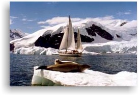
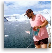
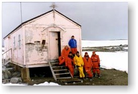
During her visit to Antarctica, Mahina Tiare’s crew met scientists and support personnel at Argentine, British, Ukrainian, American and Chilean research stations. A highlight of the trip was the time spent in Port Lockroy helping five members of the British Antarctic Survey clean and restore an historic hut. It had been built 30 years ago by another British Survey team, but had since been taken over by gentoo penguins and the elements. You really had to be there to appreciate how shoveling out three decades of penguin s__t could actually be considered a highlight of the trip.
The BAS crew subsequently sailed aboard Mahina Tiare to check another isolated hut at Dorian Bay, which Richard Atkinson had built 20 years earlier. They found that structure in excellent shape, and full of supplies from the yacht Pelagic. Gary Jobson, Skip Novak and a small crew were nearby filming segments for an upcoming ESPN special.
Weather and ice movement presented the most difficult challenges. Several times at anchor the crew had to fend off icebergs with a ‘bergy pole’-a 14-ft carbon fiber windsurfer mast with stainless spikes at the end. And the first time they tried to sail through the Lemaire Channel, they found it totally blocked by huge icebergs driven there by gale-force winds.
When venturing ashore, they were surrounded by hundreds of penguins, dive-bombing skuas and breathtaking beauty. At sea and at anchor, they encountered leopard seals, humpback whales and yet more inquisitive penguins.As you might expect, voyaging as far as 65°S latitude was a little different than sailing in most other places in the world. Being summer in the Southern Hemisphere, the air temperature ranged from 20 to 40 degrees. While downright balmy compared to winter, those temperatures and the wind chill made proper clothing essential.Topsides, the uniform of the day was layers of Patagonia and REI clothing. Typical of most of the crew, Al Maher wore lightweight capilene longjohns, followed by an REI expedition-weight polypro layer, a light cotton sweater and a Helly Hanson polypro vest. At night, he’d add a fleece-lined jacket, and when it was wet, Henri Lloyd foulies. Neal favored a Mustang Ocean Class one-piece float-suit – similar to what the Coast Guard helicopter crews use. “But the rest of the crew thought it was too warm and cumbersome,” he says.
Ski goggles were necessary in snow, sleet or high wind conditions. Keeping fingers somewhere between useful and frostbitten proved the major challenge. A three-glove system consisting of Patagonia glove liners, followed by OR (Outdoor Research) modular liner and mitts from REI worked the best.” The engine room clothesline was always full of extra liners hung up to dry,” says Neal.

The water temperature was so cold that at a couple of stops it froze hard enough to support the weight of penguins that would waddle up to the Hallberg-Rassy 42 for a look-see. The cold water was a big concern for Neal, who reports he was paranoid about catching the dinghy painter in the prop since he didn’t have a drysuit aboard. Then again, the Avon wasn’t in the water any more than it had to be, as leopard seals apparently love to attack and destroy inflatables!

A forced-air Volvo Arctic diesel furnace installed two years ago in Auckland kept Mahina Tiare warm below, even in high winds with the boat heeled way over. It was backed up by a heat-exchanger system and propane forced-air furnace, which was rarely used.

Mahina Tiare didn’t quite make it to the Antarctic Circle-66°30’S-where it would have been daylight all the time in January. But it was close. Their ‘nighttime’ consisted of four hours of twilight where “You could watch the sunset and rise at the same time,” says Maher.

This meant there was always enough light to check bearings ashore. That was a good thing, as there’s not exactly a glut of cruising guides for the area. Neal used a collection of hand-drawn anchorage charts passed down over the years from several boats. They were an indispensable addition to the British Admiralty and few Chilean charts of the Antarctic Peninsula. These latter were accurate as far as they went, says Maher, “but it’s a little harder to figure out where you are when everything’s white. The hand-me downs tell you, ‘put anchor here, put line there, there’s a spike on this hill’, that sort of thing. They’re excellent.”

Mooring had its special little nuances, too. Of nine stops, Mahina Tiare only swung on double anchors three times. The rest of the time, she was either tied to shore (usually to rocky outcroppings) with as many as seven lines, or anchored and tied to shore. Neal says the 600 feet of 5/8-inch floating polypro line he got for Chile’s Patagonian coast proved valuable in Antarctica, as well. The bright yellow line was easily visible even when it was snowing, and its flotation properties made it easier to work with when going ashore. The disadvantage: even at two feet, the tides were often enough to ‘float’ the mooring lines off of rocks.

As far as site selection for anchoring, one of the prime criterion was finding an inlet whose entrance was shallow enough to keep large bergs out-yet allow Mahina Tiare with her 6-ft draft in. Neal reports that even the big bergs move around a lot and you have to keep an eye on them constantly. “Several timed we encountered huge bergs moving with the current at 2 knots or more – to windward!” he says. At several 
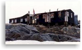
anchorage’s, ‘berg watches’ were posted aboard, and as often as not involved fending off ice with the bergy poles. Three times, the crew used the Avon to push bergs out of the way that were running over the anchor chain or nudging the boat. The weather at the bottom of the world can change rapidly, so accurate forecasts were mandatory for survival. In addition to Bob Rice’s service – which gave accurate forecasts up to five days ahead – the Mahina Tiare crew found the New Zealand ZKLF weatherfax chart (transmitted at 103OUTC on 9459.0) and Chilean charts (transmitted by CBV at 1115, 2315 and 2330 on 4228.0 and 8677.0) to be helpful. Navigation was by GPS – yes, it works fine down that far – and constant dead reckoning updates. Crewman John Graham is a ship’s captain who loves navigating under the most adverse conditions. When Mahina Tiare left Palmer Station and ended up bottled up and blocked by 90% ice and 40-knot winds in the Lemaire Sraits, John navigated from 1500 until 0300 the next morning, mostly in zero visibility and subfreezing temperatures – all flawlessly, without a single mistake. A Raytheon radar helped this process, showing even small bergy bits as the sea wasn’t too rough.

All Mahina Tiare’s stops save one were on the Antarctic Peninsula, in the island group known as the South Shetlands. Their one stop on the mainland – the actual Antarctic continent – was at Faraday Station, a former British outpost that’s now home to a group of Ukranian researches.

After five weeks in Antarctica (and 17 months in Chile), Mahina Tiare headed for warmer climes. On April 22, she departed Puerto Montt for Juan Fernandez, Easter Island, Pitcairn, the Marquesas and Hawaii. John and Amanda look forward to arriving back in Friday Harbor in early September.

Shortly after that, John will be flying to Sweden to check on construction of Mahina Tiare III, a new Frers-designed Hall-berg Rassy 46 which will arrive in Seattle by ship in December.


-John Neal and latitude 38
“Damn! This lousy rag doesn’t
have a thing about sailing
the “real” south seas”

MAHINA TIARE II’s 1996 CAPE HORN TO ANTARCTICA EXPEDITION2021-05-04T12:02:05+00:00
Go to Top